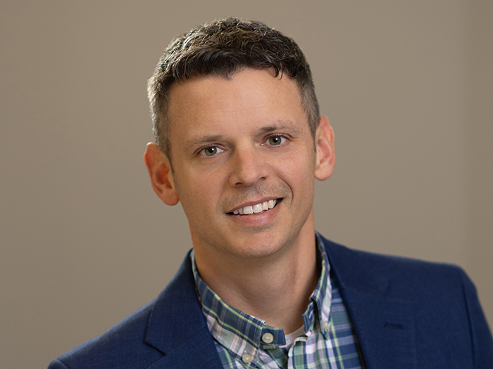
Liberty’s Jean-Christophe Garaix on the Evolution of Parametric Insurance

Dan Reynolds, the editor in chief of Risk & Insurance, recently caught up with Jean-Christophe Garaix of Liberty Mutual Reinsurance. The topic was the evolving use of parametric covers. What follows is a transcript of that discussion, edited for length and clarity.
Risk & Insurance: Thanks for meeting with us Jean-Christophe. What is the history of parametric insurance in agriculture and other industries?
Jean-Christophe: Parametric insurance started more than 25 years ago, primarily with utilities in the US looking for protection against the impact of cold winters and warm summers on production and consumption. The company I worked for at the time, which has evolved over the years, was one of the first to develop parametric products for utilities in the US and Europe, covering risks such as lack of precipitation or wind for wind farms.
The agricultural sector started requesting parametric coverage around 2003, with Canada and Mexico being among the first markets. This quickly became a booming market in both developing and developed countries, with state schemes and the agro-industry seeking protection against lack of production. Agricultural companies like aggregators and agrochemicals firms , which had an interest in crop production, began purchasing parametric covers for business interruption issues.
While utilities were the first to adopt parametric insurance 25 years ago, it was initially a niche within a niche. However, demand has been growing, with more utility stakeholders, including smaller utilities, now involved in this market. The main difference is that 25 years ago, we primarily worked with trading desks rather than risk managers, as parametric products were used to manage quality and price risks.
Today, we also work with risk managers from various industries, such as major industries looking for business interruption coverage after an event, as well as water, energy, and power networks seeking to ensure appropriate production coverage. While parametric insurance is not new, there is growing interest from a broader range of stakeholders beyond just utilities.
R&I: What types of triggers are there for solar farms in parametric insurance policies?
JC: The triggers for solar farms in parametric insurance policies can vary depending on the country and specific circumstances. While the primary trigger is usually lack of sun, in some cases, excess sun can also be a covered event.
This is because, in certain countries, utilities are obligated to purchase the power from green producers. If there is excess power production due to abundant sunlight but low demand, the utility must still pay the producer despite not needing the power. This situation can occur during mild winters when power consumption is lower than expected.
However, the structure of these policies can be complex. It’s not always as straightforward as with wind power, where coverage is typically based on wind speeds falling below a certain threshold. For solar farms, factors like temperature and power demand also come into play.
Some companies have interests in multiple countries, leading to multi-layered coverage. The specific terms can vary based on regulations in each location. Market conditions and external factors, such as the availability of alternative energy sources like gas or nuclear power, can also influence the demand for certain types of coverage from year to year.
R&I: How do earthquake-related parametric covers work, and what role does the sensor you showed me at RIMS in San Diego play in triggering the cover?
JC: The sensors are provided by Safehub, a technology provider in seismic sensor and risk management solutions. They capture building-specific near real-time data at the policyholder’s building location(s) to trigger parametric (re)insurance policies, thus playing a crucial role in earthquake-related parametric covers. When an earthquake occurs, the sensor registers the degree of shaking at the location, offering increased accuracy in assessing earthquake impacts at the building site and therefore reducing the basis risk associated with determining payouts.
If the shaking exceeds a predetermined threshold, it triggers the parametric cover, providing immediate financial relief to the insured party. Together with Safehub, we recently closed a deal with the University of California, where we are now covering all their campuses across the state using this innovative parametric approach.
R&I: What is the scope of the sensor system you are deploying across the UC system?
JC: We are putting 180 sensors on all the ten campuses across the entire UC system. The number of sensors varies depending on the size of each campus. We worked with our partner Safehub to define how many sensors are needed for each campus.
The sensors measure the shaking at the location where they are installed in the buildings. What we are selling is a service, and that’s what UC was looking for.
This solution worked for the university as a whole, balancing safety and financial considerations. The 180 sensors deployed across the campuses will provide critical information to help manage the aftermath of an event.
Based on the shaking data, each university will receive a fast payment to help manage the post-event situation, such as sending students back to dorms and starting repairs. This is a multimillion dollar coverage that will provide them with immediate cash when needed.
R&I: What is the primary purpose of using sensors in buildings?
JC: The primary purpose of using sensors in buildings is to estimate structural damage after a seismic event. When an earthquake occurs, there are often not enough engineers available to inspect every building in a timely manner to determine if it is safe to re-enter.
The sensors provide crucial information about the impact on the building in near-real time.. The system communicates the severity of the impact using a color-coded scale: blue indicates no impact, green suggests an impact but little-to-no structural issues, yellow indicates slight to moderate issues that may require an engineer’s assessment, and red signifies likely severe damage.
This rapid assessment is particularly critical for hospitals, universities, and schools, where many people need to know whether it is safe to return to the building. The sensors provide valuable data to supportinformed decisions about the structural safety of the building, even if visible damage is minimal or absent.
R&I: How complicated is it to promote sensor-based earthquake covers to large corporates?
Interestingly, on large accounts the crisis management and the risk management functions are not managed by the same people.
The crisis management team are looking for the value-add service provided by the sensor, particularly for help in determining if it is safe for students to return to dorms and other buildings. On the other hand, the risk management team is looking to optimize the value of insurance.
While these two groups may not have traditionally worked together, such cooperation is vital in developing effective earthquake parametric programs that achieve the goals of both teams.
R&I: How can parametric insurance help manage business interruption risks in the private sector, especially in the context of earthquakes?
JC: Parametric insurance is not meant to replace traditional policies but rather to add value, particularly for business interruption coverage. We partner with brokers and risk managers to develop effective solutions to the risks they face, using both traditional and parametric coverages as appropriate.
The parametric component provides additional services, information, and fast payouts,. While it doesn’t replace traditional products, it adds significant value to them.
R&I: What are some examples of private sector projects in the US that are using your sensors at a similar scope to the UC project?
JC: While UC was our first client in the US, we have already started working with a large chain of supermarkets in Mexico. In California, we are looking to support hospitals and government entities. We are also working with other private sector clients. Recently, we closed an agreement with Alliant for an exclusive approach to the US public sector with our products. They will offer our solutions to all their public sector clients.
This partnership stems from the positive experience we had working together on the UC project, as Alliant was UC’s broker. The value we provided in that project demonstrated the potential benefits for the entire public sector. Moving forward, our products will be part of Alliant’s standard offering to public sector clients in control.
R&I: What is the current state of earthquake sensor deployment in Latin America, particularly in high-risk areas like Mexico City?
JC: We have already deployed around 40 sensors in Mexico City , working with our clients. What’s interesting is that even small tremors are being detected and reported to users.
People are becoming accustomed to receiving this information, similar to how we get notifications about cold or freezing weather on our IoT devices. Users will receive the same type of information from their earthquake sensors, even for small events.
This is crucial for them to understand how the system works and that they are getting this service. It’s becoming a part of the regular information they will grow used to having, even for minor incidents.
R&I: What other uses for parametric products do you foresee emerging, beyond those already discussed such as utilities, agriculture, wind farms, solar, and earthquake sensors on buildings?
JC: Beyond earthquake and tropical cyclone coverage, which are currently the largest markets for parametric products, we see significant potential in flood coverage. This is an area that has seen substantial improvements thanks to satellite imagery.
We work with FloodBase to provide flood coverage based on the level of flooding in various US territories and other regions. Flood coverage is an exciting area of growth for parametric products, and we expect to see further developments in this space.
As far as tropical cyclone is concerned, our proprietary model measures wind speed at the specific location, which we believe is much more precise than using a second-level approach like a CAT in a Zone, as it reduces basis risk.
By using NOAA information, we can calculate wind speed at the exact location, providing a more accurate and tailored service.
R&I: What are the two options for flood monitoring, and which one is more commonly requested by the market?
JC: There are two options for flood monitoring. The first is measurement at a particular geographic location with a sensor, which is suitable for monitoring specific buildings flood levels. The second option monitors a broader geographic area – such as a city block- for floods.
We are providing both solutions. However, based on the requests we receive, the market is more interested in monitoring flood risk per area. This approach is linked to business interruption, as commercial clients are more concerned about the impact of flooding on their operations in a specific area. &


