Updated Climate Change Risk Models Are Giving Insureds and Underwriters a Better Chance to Defend and Restore Property
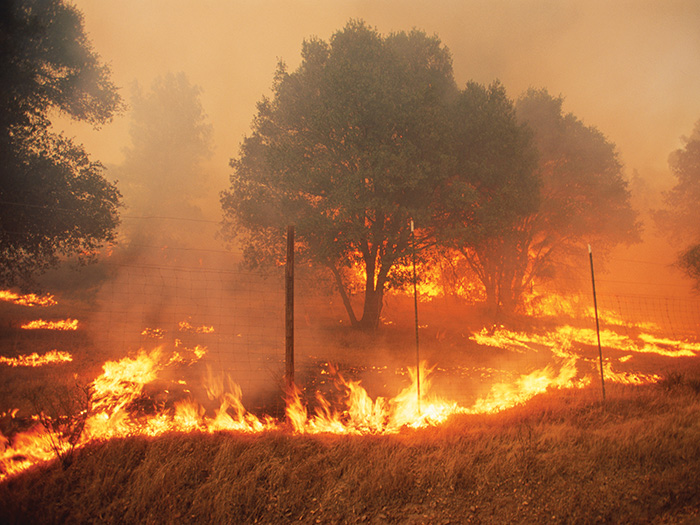
As it builds out a framework to model future climate risk, AIR Worldwide made changes last year to its hurricane and U.S. wildfire models with the goal of providing insurers and their clients with more accurate assessments of those morphing risks.
The catastrophe (CAT) modeling firm described in detail last June its longer-term project, which began three years ago and blends its “traditional hybrid, physical, and statistical approaches with a new set of tools that come from the world of artificial intelligence — specifically machine learning.” AIR anticipates the new framework will provide insight into “not only today’s new climate questions, but also tomorrow’s.”
There is “huge demand” from insurers and across industries to quantify the impact of climate change in the near, medium and long term, according to Liz Henderson, senior managing director of analytics at Aon.
A disconnect remains, however, between what CAT models can provide and what regulators are asking companies to understand about the impact of climate change on their finances.
“I think there will be a lot of development over this year and the next few years on that specific question: How to link climate change data, which tends to be global, to the stochastic models based on more current climate conditions and the high-resolution stochastic process,” Henderson said.
The publication of AIR’s June report, written by Jayanta Guin, the firm’s chief research officer, was timely given the record number and intensity of hurricanes and wildfires that unfolded throughout the rest of the year. It noted a series of articles to be published that would illuminate the new framework’s findings for different perils, including U.S. severe thunderstorm and Japanese typhoons.
In November, it published “Breaking New Ground on the Impacts of Climate Change on Hurricane Activity,” authored by Dr. Peter Sousounis, VP and director of climate change research at AIR.
Hurricane Incorporates Inland Flood Risk
The Sousounis article describes research concluding that rising sea surface temperatures (SSTs) have resulted in storms retaining intensity longer after landfall, thus resulting in more damage from wind and flooding.
Liz Henderson, senior managing director of analytics, Aon
Last year, AIR made a significant change to its U.S. hurricane model — its flagship — that reflects the consequences of rising SSTs by incorporating a module for precipitation induced flood risk.
CAT models are typically one of several factors that insurers consider to determine policy elements including premiums, deductibles and limits.
They enable aggregation of the likely damage stemming from large catastrophic events, Henderson said, allowing insurers to optimize how they allocate capital to risk regionally, globally and by business line.
She added that helps them diversify their portfolios and maintain their financial strength, to the benefit of policyholders.
By including inland flooding, said Andrew Hickman, global head of risk modeling and data science at Marsh Advisory, AIR’s hurricane model quantifies a component of hurricane risk that insurers would have to determine in some other way and can provide more certainty in terms of structuring policies.
“By quantifying the element the insurer was dealing with more subjectively before, it may reduce uncertainty and take away some amount of conservatism around estimated loss gross-up factors embedded in pricing,” Hickman said.
Prior to the model change, two locations with otherwise equal modeled hurricane risk may have carried the same “padding” on pricing to account for unmodeled hurricane inland flood risk, but now the hurricane model may show one location to have less risk of inland flooding than the other.
“Their expected loss underpinning premiums becomes more differentiated and more closely related to their risk,” Hickman said, adding that this feeds back into better flood prevention and risk mitigation, as now the riskier location may see a return on investment for putting flood-defense measures in place that was less clear before the differentiation.
Roger Grenier, SVP of the global resilience practice at AIR, noted insurers seeking to increase rates may have to submit to regulators the elements that go into the new premiums, and one element would be the results produced by a vendor or in-house catastrophe model.
“To the extent they were previously including some subjective factor to account for the hurricane induced precipitation, now they have a modeled result that reduces some of the subjectivity,” Grenier said.
“We’re helping clients fill in the gap.”
Hickman said AIR’s hurricane model change is “very exciting” from a broker’s perspective, because clients located in those areas face that risk, and “inland flooding is a significant issue that we’ve seen with just about every hurricane in 2020.”
Greater Resolution on Wildfire Risk
AIR is actively working on a wildfire model update for 2023, although it may arrive sooner or later based on market demand or wildfire activity.
Dr. Sousounis, author of the November report from AIR, said the update will include aspects of climate change and vulnerability, including better support for construction and occupancy codes and perhaps account for some aspects of wildfire mitigation.

Andrew Hickman, global head of risk modeling and data science, Marsh Advisory
In addition to the model release, he said, AIR continues to research and build a climate-framework chapter on wildfire findings.
One element being explored, he said, is the vapor pressure deficit (VPD), which is the difference between how much moisture there is in the atmosphere and how much there can be.
“That’s a better indicator of a wildfire burn area, and we’re looking at that metric in different parts of the Western U.S., the domain covered by the model,” Sousounis said.
He added that factors such as the ecology, rainfall and the direction of mountain slopes can also impact VPD.
“So we’ve quantified those relationships, to see how much things are changing, and we’ll make adjustments based on that information.”
Last June, AIR introduced new 50,000-year and 100,000-year wildfire catalogues of simulated burn events. The 100,000-year catalogue has 10 times the number of simulated events compared to the 10,000-year catalogue that was already available.
“The higher resolution — more events in a certain location — gives greater confidence on what the contribution to premiums should be,” Grenier said.
Hickman said the 100,000-year catalogue provides a “richer picture” of what could happen. Whereas the 10,000-year catalogue may provide no events at all for a certain location — awkward to explain to a client that owns property there and may recently have experienced wildfire in close proximity — the larger catalogue may indicate at least some risk.
“Instead of going from zero to risky, there’s some gradation there,” Hickman added.
He noted an office park that may be several streets away from the wild land-urban interface, where fire happening in nature encroaches on the built environment and where there is significant risk.
There may be trees and shrubbery, for example, close to the structure as well as underbrush on the edges of the parking lot. Nevertheless, models may provide only a sparse sampling.
“With 10,000 events you’re going to miss a few spots that aren’t risk free, but if you’re spreading around 100,000 events, there’s a much better chance of some of those events impacting some sites marginally, and that matters a lot in the commercial space,” Hickman said.
With 10 times as many dots, as Grenier put it, there is much greater likelihood of finding the “right combination of ignition, location, available fuels such as shrubs, and prevailing winds that all build to arrive at the point where that particular building is impacted.” &


