Risk Scenario
The Fury of Anais
Disclaimer: The events depicted in this scenario are fictitious. Any similarity to any corporation or person, living or dead, is merely coincidental.
Anais Rising
Buddy Welch, an analyst with the National Hurricane Center at Florida International University in Miami, is finishing his second cup of coffee on the morning of August 22, 2017 as he monitors a tropical wave formation off of the western coast of Africa.

Buddy looks over to his colleague Jonathan Schell.
“Hey Jon, will you come look at this a second?”
“Sure, what is it?” Schell says before walking over to Buddy’s desk and looking over his shoulder.
“Look at that,” Welch says, pointing to the satellite images on his monitor.
“That’s a very strong wave,” Schell says, watching the evidence of the strong tropical wave moving off of the coast of Africa.
“Could be the strongest thing we’ve seen all summer,” echoes Buddy.
“By far,” the two scientists say at the same time.
“We’ve got very warm water in the Atlantic right now,” Jonathan adds.
He and Buddy continue to monitor the tropical wave for signs of strengthening and possible convection. Forecast models indicate that conditions are ripe for the wave to organize quickly into a tropical storm and thereafter, a hurricane.
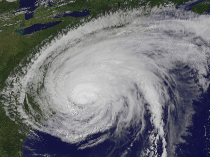
The tropical wave does become a tropical storm, dubbed “Anais,” and bolstered by unusually warm ocean water, it intensifies as it moves across the tropical Atlantic toward the Caribbean and the United States.
On August 26, Anais is upgraded to a hurricane in the tropical Atlantic, east of the Eastern Caribbean.
As the hurricane moves through the Caribbean, past Hispaniola, the National Hurricane Center notifies residents and emergency managers up and down the Eastern Seaboard that Anais poses a very real and severe threat.
Several days later, on the 1st, Anais buffets the Bahamas with high winds. It spares the Bahamas a direct hit and instead veers north- northwest and, now classified as a Cat 4, with maximum sustained winds of 150 mph, takes dead aim at the coast of North Carolina.
Ray Bonner, risk manager for the City of Norfolk, Va. is one of those who takes heed.
Bonner immediately convenes Norfolk’s crisis management team, which is more sophisticated than many because it has a “business resilience” subcommittee that is dedicated to coordinating with municipal officials in the event of a natural catastrophe. The committee’s mandate is to help businesses open as soon as possible in the aftermath of a major storm.
“This hurricane could hit every coastal city from Wilmington, N.C. to Boston,” Bonner tells his assembled crisis management team.
“We can’t be sure that we’ll get much help from neighboring emergency responders if that’s the case,” he tells the committee.
On Labor Day, September 4, Anais strikes Wilmington, N.C. as a Cat 4. The storm cripples the Wilmington power grid and causes 13 deaths.
All Fall Down
Despite the damage done by Anais in Wilmington, Bonner and other members of Norfolk’s crisis management team are frustrated by what they see as a lack of sense of urgency in some quarters to evacuate as necessary and take proper precautions. Perhaps distractions due to end-of–summer Labor Day plans are partially to blame, they reason.

Well before the hurricane made landfall, Bonner and risk managers from other East Coast cities got on a conference call to discuss the storm’s potential impact and how each city might coordinate with the other to assist in recovery.
“This could end up being every bit as bad as Hurricane Sandy,” said Elizabeth Acres, the risk manager for Boston, Mass.
“Or worse,” said Jay Baker, the risk manager for New York City.
“You ever heard of the Norfolk/Long Island Hurricane of 1821?” Baker says.
“No,” says Acres and others simultaneously.
“I’ll send you the link,” he says. “Path of Anais looks very similar to the path of that 1821 hurricane.”
On September 5, Anais, still a Cat 4, hits Norfolk. Without losing strength, the hurricane continues north, striking Cape May, N.J., New York City and Connecticut in turn.
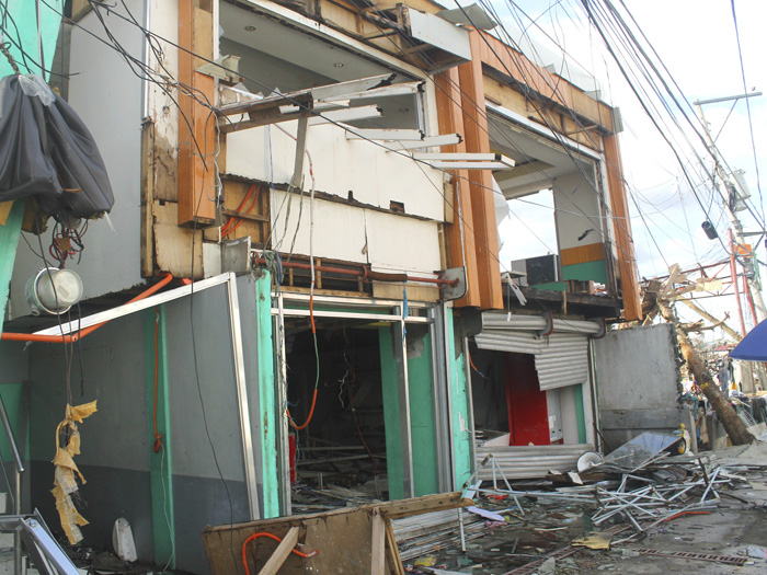
The storm is every bit as damaging as Hurricane Sandy was, and causes historical levels of wind and flood damage throughout the Washington, D.C. to Boston megalopolis.
Back in Norfolk, Bonner, along with the city’s emergency response coordinator Jim Christopher, is touring flooded sections of the city on September 7 in a zodiac that’s equipped as an emergency response boat.
They’re touring one of the city’s business districts, which is still inundated with three feet of water. The zodiac reaches the end of a block and Christopher eases off on the throttle.
The two men stare at the devastation in the deserted business district in silence. They can see dresses and hats floating, half-submerged in the gray flood waters, through one of the few intact store windows.
“I don’t see when these businesses can re-open,” Bonner says.
“I don’t see when we even get into these shops to have a look at them,” Christopher says.
***
On September 12, Bonner again gets on a conference call with his fellow risk managers from cities in the Northeast. Accompanying them on the call is Ray Harbridge, a Northeast Regional Director for the Federal Emergency Management Agency.
Boston’s Elizabeth Acres leads the dialogue with Harbridge.
“Ray, can you update us on the timeline for any funding assistance we might get from Washington?” Acres says for openers.
“We have no answers in that area Liz,” Harbridge says.
“We’re dealing with an unprecedented level of damage to the six largest cities in the East,” Harbridge said.
“First impressions are that we have millions of people affected,” he said.
“And that’s not even getting into the business impact,” Bonner said.
“That’s correct,” Harbridge said.
“We’ve got to concentrate on housing and medical care for those most vulnerable and those displaced,” he said.
“I know you’ve got plenty of worries on your end, but you’re going to have to rely on your own resources for the foreseeable future. I really don’t know when we see a way clear of all this,” he said.
“Let’s face facts folks,” New York’s Jay Baker said after Harbridge, extremely pressed for time, hung up.
“We still haven’t received federal reimbursement for Hurricane Sandy damage and expenses in some cases, and we’re five years out from that.”
“We’re going to be at this a long time,” Boston’s Acre said.
“You can take that five years from Sandy and double it,” Baker said.
Bankrupt Hopes
Ever since he heard the first indication from the National Hurricane Center that Anais should be watched, back in late August, Ray Bonner’s mind had been turning on something.

When Hurricane Sandy struck New Jersey and flooded Lower Manhattan in 2012, it caused a permanent shift in Bonner’s thinking.
Before Sandy, the idea that a major hurricane would come near enough to cause substantial damage in New York was thought to be a “Black Swan” event, something with an extremely low possibility, albeit having potentially devastating consequences.
After Sandy, Bonner began to think about ways to mitigate the costs of a major hurricane strike. He’d begun discussions with the City’s budget director and its finance committee on the possible purchase of layers of reinsurance that could help the city defray not only the costs associated with hurricane clean-up and repair, but the lost property tax and business income tax revenue should the region’s homes and businesses take a big hit.
Presentations Bonner made on the Norfolk/Long Island Hurricane of 1821 to city finance officials left them unmoved, though. It wasn’t that city leaders were callous to Bonner’s concerns. But pressing matters like negotiations with unionized police and firefighters took up most of their attention.
Norfolk’s finances were basically sound. Bonner’s attempts to sway city leaders to a different way beyond floating bonds and raising taxes on the back end in the event of a catastrophe just couldn’t gain any traction. City officials felt that they had things under control and didn’t want to start piling on new expenses like insurance premiums.
Six months after Anais struck, analysts released data that showed the storm caused $40 billion in wind damage and $70 billion in storm surge damage to cities and towns from Wilmington, N.C. to Boston.
What Bonner considered a real threat after Sandy struck turned out to be true after Anais. Norfolk city finances, which had previously been solid, began to deteriorate.
Twenty percent of the Norfolk/Virginia Beach region’s housing stock was rendered uninhabitable by Anais. Reductions in property tax revenue, coupled with business tax revenue reductions, were creating budget deficits in Norfolk and in every other city that was hit by Anais.
That public sector pain was being repeated in the private sector. Loss of mortgage interest and principle payments, a lynchpin of the banking system, led to the failures of dozens of regional banks and severe limitations on the revenue of the larger banks.
In 2021, four years after Anais hit, the Rand Corporation released a study, titled “The Anais Effect” which estimated that the economic damage from Anais restricted growth in the Northeast by seven percent from 2017 to 2021.
Rand Corp. researchers estimated that by 2027, 10 years after the storm, an “Anais Recession” — the first ever regional economic recession connected to a natural catastrophe — would limit growth on an annual basis in the Northeast by five percent.
![]()
Risk & Insurance® partnered with Swiss Re Corporate Solutions to produce this scenario. Below are Swiss Re Corporate Solutions’ recommendations on urban and corporate resilience, and a reminder about the company’s global expertise in the areas of Nat Cat modeling and disaster preparedness. This perspective is not an editorial opinion of Risk & Insurance®.
The 1821 hurricane struck the mid-Atlantic and Northeast United States at a time in history when human population and concentration of value were dramatically lower than present day. In fact, only 136,000 people lived in Washington and New York at the time. If a major catastrophic event like the 1821 Norfolk Long Island Hurricane was to happen today, it would cause 50% more damage than Sandy and potentially cause more than $100 billion in property losses stemming from wind damage and flooding from storm surge.
That’s just one part of the story, however. Taking into consideration lost tax revenue due to destroyed homes and business, lower real estate values and other economic considerations, the broader economic impact would grow to over $150 billion. That’s well above the aggregate losses of all storms which recently impacted the Eastern United States, including Hurricane Sandy.
With an eye toward a future event that could dwarf Sandy in terms of insured and economic losses, Swiss Re has published a new report that analyzes the 1821 hurricane and how a repeat event would impact the region today. Download the report at: http://media.swissre.com/documents/the_big_one_us_hurricane_web2.pdf
To prepare for such a future event, large scale urban resilience must be at the forefront of the risk management community. Of course, protecting lives should be the highest priority for city authorities seeking to improve their disaster preparedness. Beyond that, municipalities and businesses – large and small – must work together to ensure critical infrastructure and supply chain redundancy. This can be accomplished, in part, by more fully understanding the geographic hazards via advanced modeling techniques using Swiss Re’s CatNet® tool.
CatNet® – Advanced Modeling
Combining satellite imagery with Google MapsTM and Swiss Re’s proprietary historical data, CatNet® allows risk management professionals to analyze worldwide natural hazard exposures. CatNet® features:
- Natural hazard atlas
- Country-specific insurance data
- Disaster statistics
This allows risk managers to prepare local, regional and cross-regional risk profiles to assist management in disaster preparedness. The result is a more informed viewpoint about a company’s or city’s insurance considerations and potential enterprise risk management gaps. An organization’s disaster preparedness can be further enhanced by partnering with local authorities, businesses and municipal leaders to ensure community-wide resilience.


